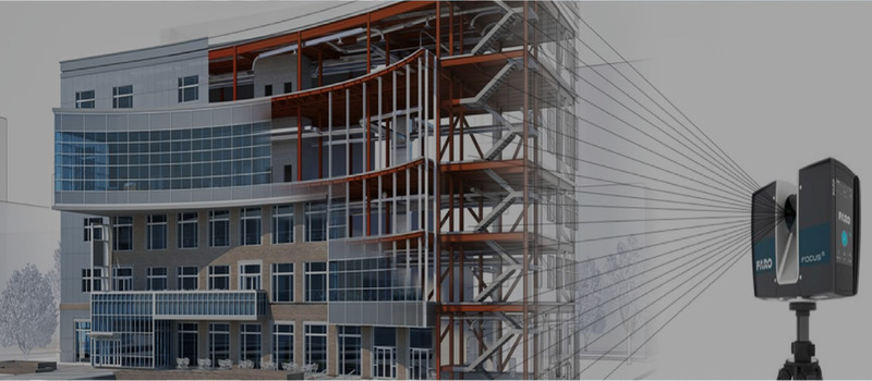
QeCAD offers accurate and comprehensive Point Cloud to BIM Conversion Services for renovations, remodeling, and restoration projects across the USA, UK, Australia, New Zealand, Canada, and Other European regions. We hold an extensive experience of 25+ years and have catered to various point cloud modeling projects of all sizes, types, and complexities. With our Point cloud to BIM Services, architects, engineers, contractors, and other team members can avail the detailed insights from Architectural, Structural, and MEP perspectives for the renovating project and can execute the same without any glitches. Our As-built models are precise and include details like geometry, dimensions, and documentation that can significantly help depict the existing condition of the renovation site. We ensure that the curated model solution follows the building standards and codes using advanced technology and software and is embedded with the required Level of Detail (LOD100-500) to carry out the renovations successfully. Our remodeling solutions are cost-effective, competitive, qualitative, and efficient and can serve all your project needs.
We extract all the architectural element information from the point cloud and convert it into an accurate model depicting floors, ceilings, roofs, walls, windows, doors, furniture, fixtures, stairs, and many more to carry out the renovation effectively.
We extract all the structural information from the point cloud and convert it into a detailed structural model showcasing elements like beams, columns, trusses, base plates, steel supports, etc., with utmost precision so that the structural integrity of the renovation project is maintained.
We extract all the data from the point clouds to provide a comprehensive and intuitive 3D model showcasing the Mechanical (HVAC), Electrical, and Plumbing components for the renovations and restorations precisely to ensure a well-coordinated model.